In support of my webspace rental fees pllease donate generously at GoFundMe or Patreon
Thank your for visiting.  If you enjoy this site
 please make a donation.

Aerial View of Bridge River Valley, early 1950s

British Columbia's Bridge River Valley


The Bridge River is - or was - one of the Fraser's largest tributaries, although it is largely obscure to most British Columbians today.  This page is devoted to the grand scenery of the valley and its surrounding ranges, and includes rare pictures from before the flooding of its upper basin, and of the time of the flooding itself.  Other pages on this site deal with the river's famous goldfields and goldfield towns, and with the epic Bridge River Hydroelectric Development, both of which were major contributions to the province's history and economy but which, like the whole area today, are largely forgotten.  Pictures of the Bridge River Fishing Grounds, the famous Sxetl of local Indian culture, are on a separate page.

First entering the history books as "Shaw's River", after one of Simon Fraser's party, and known to the native people as 'Xwisten (sometimes spelled Nxo'isten), the river acquired its present name due to the location at its confluence with the Fraser of a toll bridge erected at this location to connect Lillooet to the northward continuation of the Cariboo Road through Fountain and Pavilion.  Until the construction of the Royal Engineers' bridge at the outlet of Lillooet Canyon, which is the river's gorge between the Bridge River and the town of Lillooet, the old toll bridge at Bridge River, as the locality was known in the days when it was a booming settlement with several saloons and other businesses.  The placename Bridge River has also been applied to the hydroelectric townsite at Shalalth, and is today used by the rural community surrounding the confluence of the Bridge River with the Yalakom River, its last main tributary before its confluence with the Fraser. 
BC Archives # I-52525, Bridge River Valley above Dam, 1920s (before Carpenter Lake)
BC Archives # I-52525


BC Archives # NA-03796, Trail up N. Fork of Bridge River, 1913
BC Archives # NA-03796
View of Bridge River Valley during flooding, late 1950s
BC Archives # I-22304


View of Bridge River Valley during flooding, late 1950s


Dunlop's Store


Dunlop's Store Bridge River Valley, 1930s
BC Archives # A-03499
Dunlop's Store in Bridge River Valley, 1930s
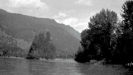
These two views of John Dunlop's store - evidently taken on the same day by their numbering and by the vehicle depicted - bely the unique location of this enterprising establishment, which lay miles upon miles from the nearest other settler - other than Durban's Ferry, a few miles downstream (behind the viewer).  Today's Road 40 along Carpenter Lake is a couple of hundred feet up the mountainside at right; the old road and what's left of this house deep beneath the chilly waters of the reservoir.  The store, which also carried gas (of course), was ideally located for business at something of a midway point between the goldfield towns and the railway basetown at Shalalth.  Travellers from the outside world would have just come in via the torturous steeps and switchbacks of Mission Mountain, necessarily needing a break from the road as well as food and drink and gas - and quite likely some repairs, major or minor; conversely people coming down from the goldfield towns would need a stop just before making the crossing of the river and the ascent and descent of Mission Mountain.  I seem to recall being parked outside it for a nap while Dad went in for a while - on more than one occasion - but I was pretty young then, as I was born in '55 and the lakewaters rose in '58.  I suspect there were legendary cardgames played and mountainman's tales told in this place, as in other cabins along the goldfield roads.  The Dunlop family remained a pioneer founding family of the non-native community in Lillooet, and the proprietors of the store were well-known to all who lived in the district in the old days.
BC Archives # NA-04644, Bridge River in flood near Rexmount P.O.
BC Archives # NA-04644


View of Bridge River Valley during flooding, late 1950s
Deer in clearcut, Bridge River Valley, 1950s
 
View of Mt. Sloan and Greenmount from Lajoie Dam

View of Mt. Sloan from Lajoie Dam, 1990s


Rexmount Bluff

Photo: Mike Cleven This stormy-looking crag was actually a dramatic golden pink when I took this shot, although the dark and looming cloud was just as it appears. The cliffs are the front face of a half-dome formation hanging over the site of the old Rexmount Ranch, which was the farthest downstream of the upper Bridge River valley's community of ranches and the first to be inundated by the rising waters of today's Carpenter Lake after Terzaghi Dam was built to divert the Bridge into Seton Lake through Mission Mountain. By no means the largest escarpment in the region and actually a mere foothill by local standards, this often-unnoticed bluff is at least 1000 ft of sheer rock and towers twice that above the lakeside road. 
tent cabin in Bridge River Valley, late 1950s