BC Archives # A-03519 |

BC Archives # NA-12693 |
The Douglas Road
BC's first "highway"
Also
variously called "the Lakes Route", "the
Douglas-Lillooet Trail" or "the Lillooet Trail"
|
The Douglas Road no
longer exists, although it was the first road built on the
Mainland Colony. The territory through which its route ran is
today one of the lesser-known in the whole province and its economy and
communities are among the most remote and the most neglected.
Yet
the importance of this area to the history of BC cannot be
underestimated, even though later routes such as the Cariboo Road and
the Dewdney Trail get all the glory - even the obscure and short-lived
Brigade Trail gets more
press!
Yet this once-vital route
followed a connecting series of lakes and portages that led into the
heart of the Fraser Canyon, many miles above
its impassable lower
stretches nearer Yale. Men were already
starting to throng the
route, hacking their way through the brush of its southern overland
segment and braving the Indian-controlled country between there and the
Canyon.
As part of his efforts to exert British authority on the
Mainland, which was at risk of being officially overrun by American
"Manifest Destiny" (in a possible overturning of the 1846 Oregon
Treaty,
which had set the boundary at the 49th Parallel), Gov. Douglas
chartered
contracts on the building of a wagon road from the head of Harrison
Lake, henceforth known as Port Douglas, through to Cayoosh Flat (which
didn't get its modern name of Lillooet
until a few years later).
|
| HBC explorer A.C.
Anderson, who had inspected the route in 1846, advised that it was
[quoting Mrs. Edwards] "only
feasible except in emergency. [but] A great emergency had arrived
- a life-line must be built to the men on the Upper Fraser, who were in
dire need. Also below, at the coast, a motley horde of
adventurers
were detrmined to reach the goldfields by an means or at any
cost.
[Gov.] Douglas had no extra money to spend, so he called a meeting with
a group of miners at Victoria and explained the situation. They
agreed to build the trail themselves without pay." Normally people who
work on road-building enterprises get paid at least slave wages for
their hard labour, but in this case 500 men signed up and agreed to pay
$25 each for the privilege of working on the road, perhaps in the
knowledge that they would get to the goldfields a lot sooner than
others, and also would stand a good chance of discovering any
goldstrikes along the route (there weren't any of note, other than some
that were found until much later, notably the Cayoosh Creek strike of
1884-1898 near the Trail's terminus by the Fraser). Mrs. Edwards
notes that the crews who worked on the Douglas Road were "composed of
many nations, British, Americans, French, Germans, Danes, Chinese,
Africans and Mexicans" and that they were organized in crews of 25 men,
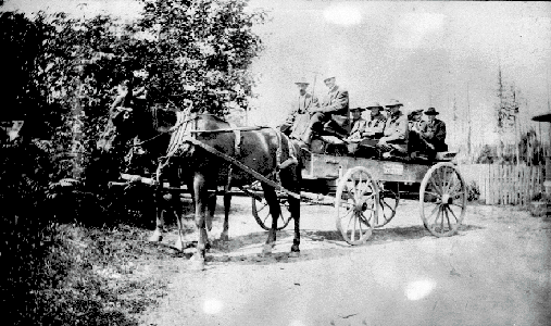
each with their own elected "captain". |
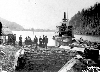
| The first group of
250
were deposited by the steamer Umatilla
near the native village of Xa'xtsa at the
head
of Harrison Lake in mid-July of 1858,which they promptly named "Port
Douglas", a name that survives on the map to this day; the other 250
followed later in the summer. Work was slow and often fights
broke
out between the men, and the lower Lillooet River's persistent rain and
rocky, swampy terrain didn't help things out, but the first rough
makings of the road were finished by October. Even before it was
done, men were moving through the route on their way to the rich bars
on
the Fraser around Lillooet; once it was completed tens of thousands of
men poured through it, using everything from rafts to whaleboats to
native canoes to get to Port Douglas, hauling some of these to Lillooet
Lake where they were abandoned at the shores of the Long Portage.
At D'arcy, called Port Anderson then, there was "no lack of Indian
canoes" to carry them across to Short Portage, and from there again to
the foot of Seton Lake, where the last bit of the Douglas Trail
connected to the shores of the Fraser and the booming settlements at
Cayoosh Flat and Bridge River. |
| Over the next few
years, improvements to the Douglas-Lillooet route were made by the
Royal
Engineers, but even as they finished the route had begun to be disused
in preference to the newer routes the Engineers had built through the
Fraser Canyon. Port Douglas was nearly forgotten by 1880 although
traffic along the route continued, especially along the stretch from
the
Pemberton Valley through to Lillooet, and steamer service was continued
on the last two lakes of the route, Anderson and Seton, well into the
mid-20th Century to service those communities. |
| The lore of the
Douglas Trail is too rich to even begin telling tales from here, and I
must refer you to the histories of the region, and to early histories
of
BC that discuss it, for some of the colourful details of the route and
the many adventures had along it by travellers in frontier times.
The route was never popular - as explained in Judge Howay's
commemorative essay on the Royal Engineers "The road had never been popular with the
travelling public owing to the delays in making connection with the
steamers on Lillooet, Anderson and Seton Lakes", despite the first
eager wave of uncounted thousands who used it to get to the upper
Fraser
and beyond to the Cariboo. Pressure mounted on the government for
a shorter and less water-logged route to the Interior, resulting at
first in work on detours around the Fraser but much closer to it,
ultimately resulting in "the eighth wonder of the world", the
better-known but second
Cariboo
Road from Yale via Lytton and Spences Bridge to connect with the first Cariboo Road, also known as
the Lillooet Road (not to be confused with the Lillooet Trail...) which
began at Cayoosh Flat (now Lillooet). |
The 150th Anniversary
of the Douglas Road approaches in 2008, along with the 150th
Anniversary
of the Mainland Colony. The route has begun to gain attention
from
mountainbikers and 4x4 enthusiasts because of the connection to Port
Douglas from the Fraser Valley made by logging roads from the Chehalis
area near the Harrison River. Only a few stretches of the
original
wagon road remain, and none are formally protected or surveyed or
marked, and there are no longer commercial ferry services on any of the
lakes concerned although recreational boat travel on Anderson and Seton
Lakes is common enough. The story of the route's original
contract
has me wondering about re-using this road-financing today - if 500
people can be signed up to pay $25 each towards restoration and
promotional work on the road - that's $12,500, which maybe could get
matching funds from one of the heritage branches of the federal or
provincial governments. Not that similar sums aren't needed by
other heritage projects needed in the same region, but it's an
interesting idea and one befitting a quincentenary recognition and
recommemoration of the route. It's worth mentioning also that in
1858 $12,500 was a small fortune - in the hundreds of thousands in
today's terms - and that the history of the road's budget was that,
like
so many other government contracts in BC's sordid political history,
fraught with scandal, graft and corruption........the province's first
road contract, in other words, was also one of its first scandals......
|
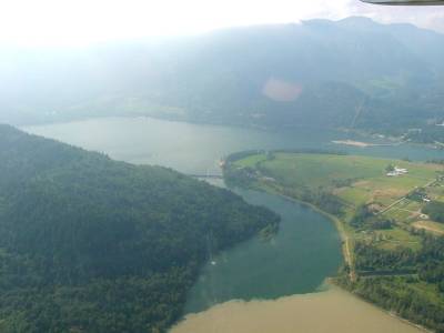
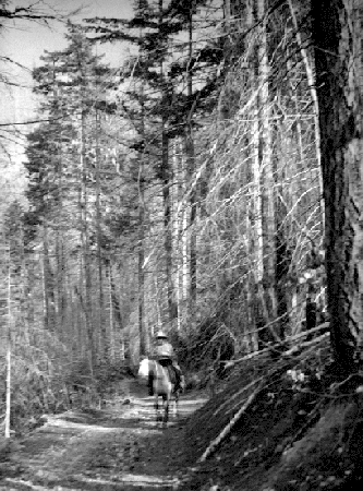
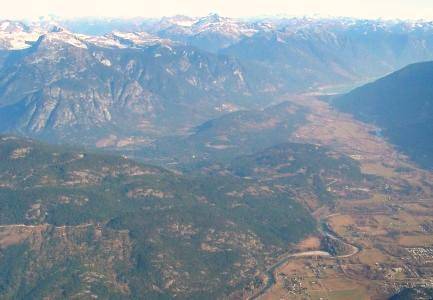
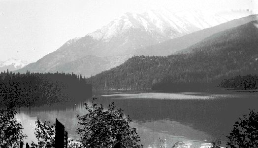
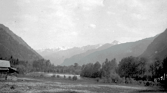
The rest of this page
is a visual journey up the route used by travellers on the Douglas
Road. Pictures are arranged
more or less in sequence, with illustrative scenics where appropriate
and as available. The links below are to sections on this page;
there are links within each section to full pages on some subjects.
|
|
|